|
|
|
|
|
|
|
|
Wtb
by 270 guru. 04/06/25 12:21 PM
|
|
|
|
|
1
|
2
|
3
|
4
|
5
|
|
6
|
7
|
8
|
9
|
10
|
11
|
12
|
|
13
|
14
|
15
|
16
|
17
|
18
|
19
|
|
20
|
21
|
22
|
23
|
24
|
25
|
26
|
|
27
|
28
|
29
|
30
|
|
|
|
|
|
106 registered members (m97, NVM1031, rwh1, WPZJR, GomerPyle, jdhunter2011, Skullworks, odocoileus, Country, blazer625, brushwhacker, Dog, Ol’Tom, ronfromramer, 7PTSPREAD, taggedout, Hunting-231, Squadron77, 1hunter, jmj120, BrentsFX4, Mully, courseup, techtony, Sasquatch Lives, CeeHawk37, Luxfisher, Dubie, Quack Quack Bang, DGAMBLER, Big Game Hunter, Big AL 76, Tree Dweller, Avengedsevenfold, Johnal3, UncleHuck, Dean, trlrdrdave, DEDTRKY, Turkey_neck, Showout, Lvlhdd, lckrn, crocker, BamaGuitarDude, Mack1, jacannon, Kdog, Jdkprp70, Woody1, Chiller, sawdust, Skillet, Standbanger, jellyhead, fur_n_feathers, capehorn24, TDog93, Redryder, thayerp81, 3Gs, Mike32, Overland, Cannon Kid, HBWALKER14, knock him down, globe, gman, JLMiller, Cactus_buck, mdf, dwaugh, ParrotHead89, cmontgomery, DoubleB, Tall Dog, CCC, DryFire, coosabuckhunter, BOFF, Chaser357, RareBreed, Whitebone, Raspy, AU67Skeeter, YellaLineHunter, Bigem1958, TurkeyJoe, Emile, Irishguy, Ridge Life, JKlep, Morgan, HHSyelper, auman, GrandSlam, Jwoods32, 9 invisible),
1,018
guests, and 0
spiders. |
|
Key:
Admin,
Global Mod,
Mod
|
|
|
 Re: Do you use hunting apps on your phone?
[Re: mw2015]
#1448860
Re: Do you use hunting apps on your phone?
[Re: mw2015]
#1448860
09/13/15 07:29 PM
09/13/15 07:29 PM
|
Joined: Feb 2013
Posts: 516
Gulf Breeze FL
TatSoul

4 point
|
4 point
Joined: Feb 2013
Posts: 516
Gulf Breeze FL
|
best app ever made for hiking and the woods is called alpine quest.It absolutely does not get any better than that.it has map areas you can download so you can still have your maps without a signal.you can draw perimeters on it,store as many waypoints and change colors for food plots and etc,\ It will also rotate the map to the direction you point using the compass feature so you can walk to a point in the dark and it will put you right on it.also can zoom to a point and it will give you exact distance in yards or miles.none of those other apps come even close. I use the free hunting app for wind =and scent cone.Heres some screen shots.It will also measure areas you mark off in square yards miles or acres.You can lay out a property in a day and record all the roads and trails and save em for later use.You can also take a picture and store it with the waypoint.No other program i ever found will do what this program will do period.and ive downloaded em all.PS dont let anyone else in the club know you got this or they are gonna wanna throw you out because you will know the property better than the ones who started the club.wonder how you know about all there private areas and shortcuts and constantly see and kill deer.thats a fact jack. 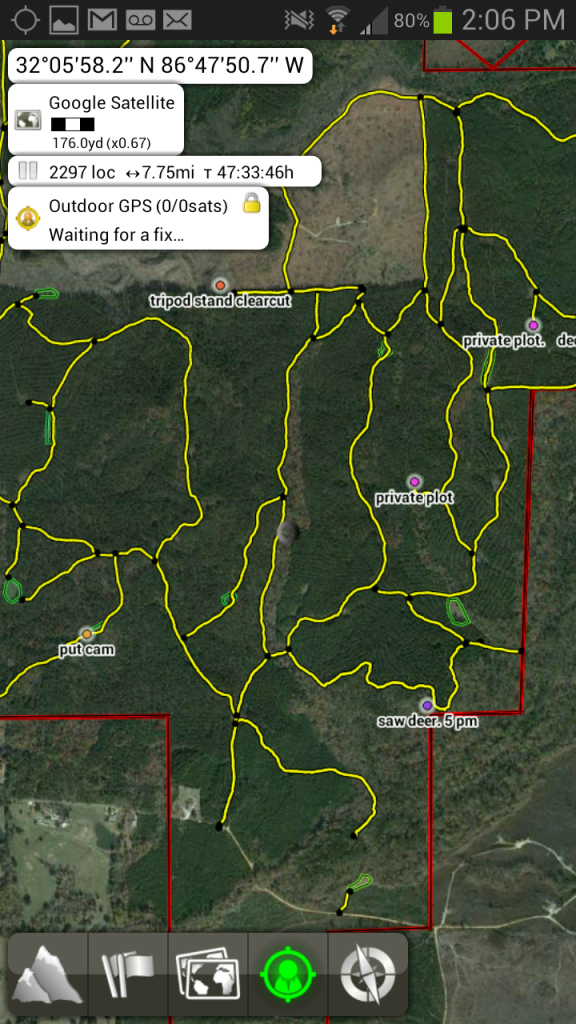 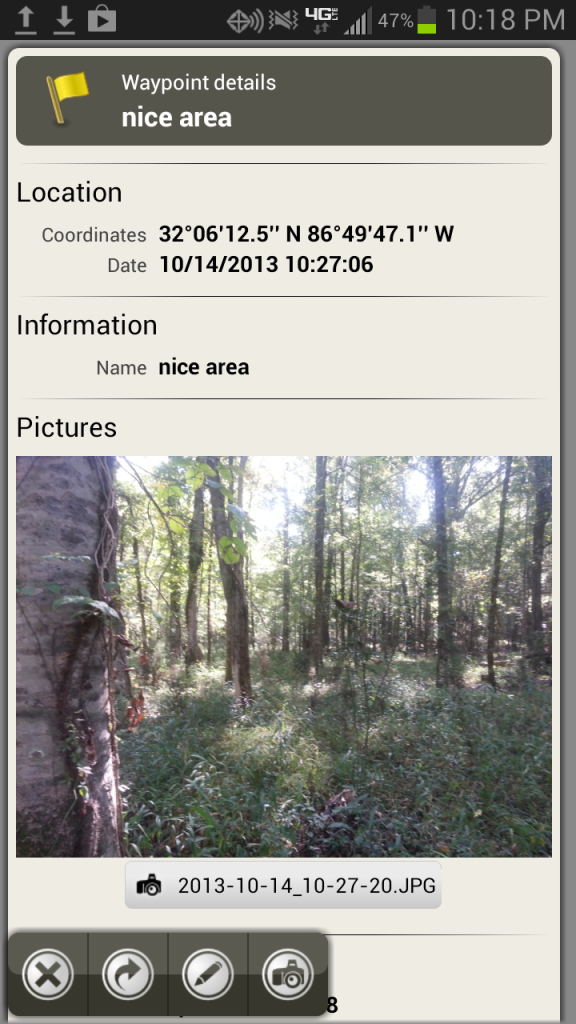 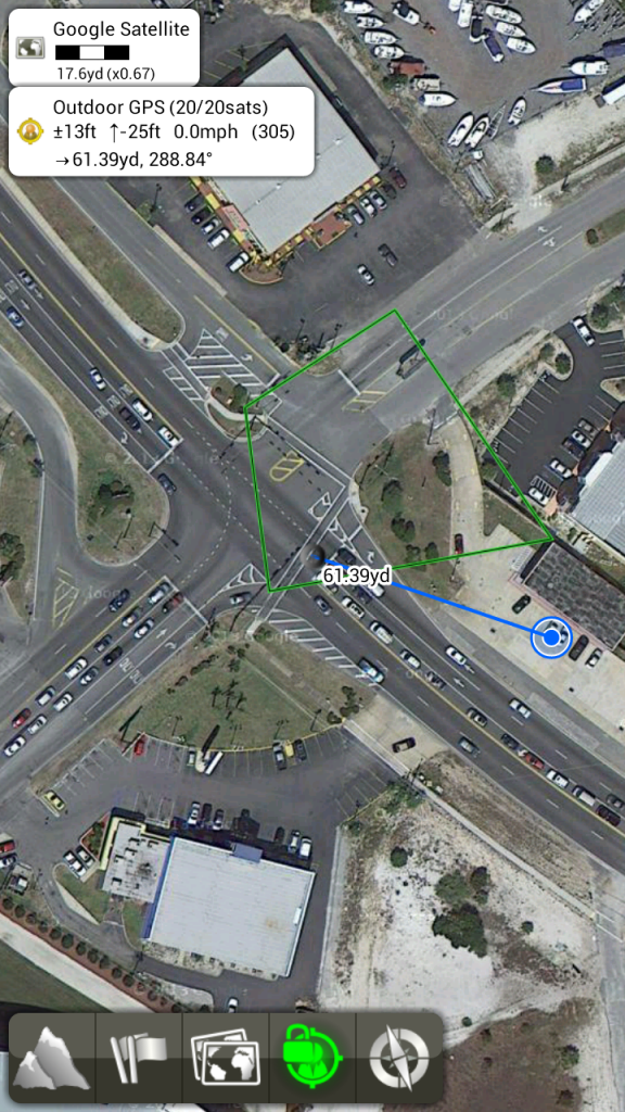
Last edited by TatSoul; 09/13/15 07:42 PM.
|
|
|
|


